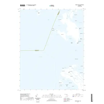
2019 Map of Kedges Straits
USGS Topo · Published 2019About this map
The complex shoreline of Smith Island dominates the southeastern reaches of this maritime study, revealing a landscape defined by tidal guts and salt marshes. The jurisdictional boundary between Dorchester Co and Somerset Co bisects the open waters of the Chesapeake Bay and Holland Straits, marking the administrative divide across these coastal shallows. To the north, the remaining landmass of Holland Island sits isolated near Holland Island Bay, while the central portion of the map is punctuated by smaller features like Pry Island and Jones Island. Along the eastern edge, the transition into Tangier Sound is marked by distinctive hydrographic points such as Musclehole Bar and Solomons Lump. The intricate network of waterways, including Fishing Creek and Joes Ridge Creek, illustrates the navigational challenges and traditional waterman territory of the Maryland coast.
Find a feature on this map
57 named features on this map. Tap any name to fly to it.
Don’t see what you’re looking for? This feature index may not catch every label — zoom into the map to look around manually.
Map Details
Editions of this 2019 Kedges Straits Map
This is the sole edition of this map. No revisions or reprints were ever made.
Other maps of this area

1898 · St. Marys
USGS Topo · 1:125,000

1903 · Crisfield
USGS Topo · 1:62,500

1903 · Bloodsworth Island
USGS Topo · 1:62,500

1903 · Deal Island
USGS Topo · 1:62,500

1906 · St. Marys
USGS Topo · 1:125,000

1917 · Ewell
USGS Topo · 1:62,500

1920 · Crisfield
USGS Topo · 1:62,500

1942 · Terrapin Sand Point
USGS Topo · 1:24,000

1942 · Kedges Straits
USGS Topo · 1:24,000

1942 · Ewell
USGS Topo · 1:24,000