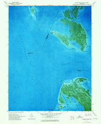
1972 Map of Kedges Straits
USGS Topo · Published 1975About this map
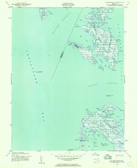
Smith Island and South Marsh Island anchor this orthophotomap of the Chesapeake Bay's intricate marshland geography. The terrain is characterized by a dense network of tidal guts and coves, including Pungers Cove and Sedgy Pt Cove, which slice through the low-lying wetlands. Much of the southern portion of the sheet is dedicated to the Martin National Wildlife Refuge, where features like Joes Ridge and Noah Ridge provide subtle topographic variation amidst the water. Navigational landmarks are essential in this maritime landscape, specifically the Solomons Lump Lighthouse and the Holland Island Bar Lighthouse positioned within the Kedges Straits. The map also records the location of a Lookout Tower near Maddox Creek, reflecting the area's significance for coastal monitoring and conservation in the early 1970s.
Find a feature on this map
61 named features on this map. Tap any name to fly to it.
Don’t see what you’re looking for? This feature index may not catch every label — zoom into the map to look around manually.
Map Details
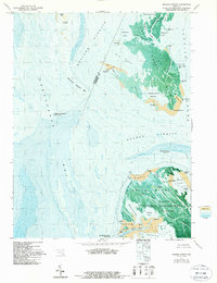
Editions of this 1972 Kedges Straits Map
2 editions found
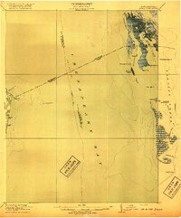
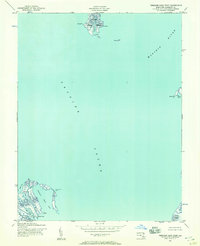
Other maps of this area

1898 · St. Marys
USGS Topo · 1:125,000

1903 · Crisfield
USGS Topo · 1:62,500

1903 · Bloodsworth Island
USGS Topo · 1:62,500

1903 · Deal Island
USGS Topo · 1:62,500

1906 · St. Marys
USGS Topo · 1:125,000
1917 · Ewell
USGS Topo · 1:62,500

1920 · Crisfield
USGS Topo · 1:62,500
1942 · Terrapin Sand Point
USGS Topo · 1:24,000
1942 · Kedges Straits
USGS Topo · 1:24,000

1942 · Ewell
USGS Topo · 1:24,000