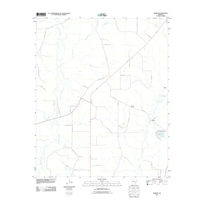
2011 Map of Kedron
USGS Topo · Published 2011About this map
Derrieusseaux Creek and Allgood Creek meander through this forested landscape of Jefferson County, defining the drainage patterns of the region south of Pine Bluff. The map captures the quiet rural character of Kedron and Rone, where settlement is primarily concentrated along corridors like Dunkeefie Rd and Mount Carmel. For local history researchers, the presence of Randolph Cemetery, Macedonia Cemetery, and Hudson Cemetery provides vital geographic context for family lineages in this corner of Arkansas. To the east, Dunkeffie Lake is a prominent water feature controlled by the Lake Dunkeffie Dam. The network of forestry roads, including Forestry Road 9239 and Forestry Road 9245, underscores the importance of the timber industry and land management in the early 21st century.
Find a feature on this map
46 named features on this map. Tap any name to fly to it.
Don’t see what you’re looking for? This feature index may not catch every label — zoom into the map to look around manually.
Map Details
Editions of this 2011 Kedron Map
This is the sole edition of this map. No revisions or reprints were ever made.
Other maps of this area

1953 · El Dorado
USGS Topo · 1:250,000

1955 · Little Rock
USGS Topo · 1:250,000

1956 · Little Rock
USGS Topo · 1:250,000

1957 · El Dorado
USGS Topo · 1:250,000

1958 · El Dorado
USGS Topo · 1:250,000

1960 · El Dorado
USGS Topo · 1:250,000

1960 · Little Rock
USGS Topo · 1:250,000

1962 · Pine Bluff
USGS Topo · 1:24,000

1962 · Faith
USGS Topo · 1:24,000

1962 · Pine Bluff NW
USGS Topo · 1:24,000