Loading...
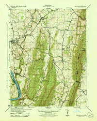
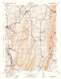
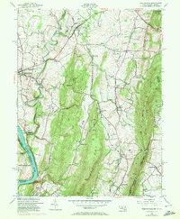
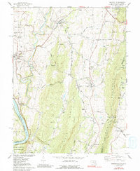
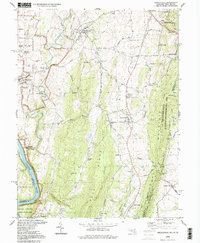
Loading map...1944 Map of Keedysville
USGS Topo · Published 1944About this map
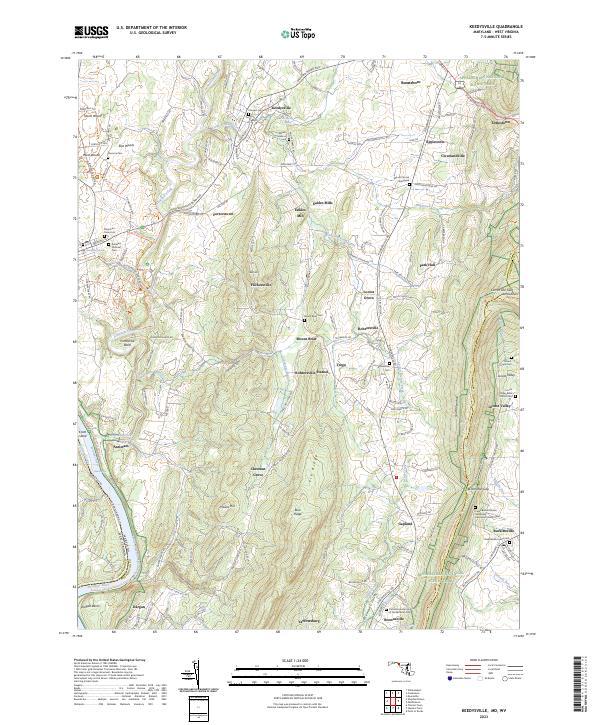
Keedysville and Sharpsburg anchor this mid-century landscape where the memory of the Civil War meets a modernizing agricultural region. The Antietam National Cemetery and the iconic Burnside Bridge stand as prominent landmarks near the winding path of Antietam Creek. Along the western edge, the Chesapeake and Ohio Canal follows the Potomac River, documenting a legacy of water-borne commerce that existed alongside the Baltimore and Ohio railroad corridor.
Find a feature on this map
52 named features on this map. Tap any name to fly to it.
Don’t see what you’re looking for? This feature index may not catch every label — zoom into the map to look around manually.
Map Details
Date Portrayed1944
Date Published1944
PublisherU.S. Geological Survey
Map TypeTopographic
Scale1:31,680
Physical Dimensions17.1 x 21.4 inches
Editions of this 1944 Keedysville Map
2 editions found
Historical Maps of Boonsboro Through Time
8 maps found
Featured Locations
Source Details
SourceU.S. Geological Survey
CopyrightPublic Domain