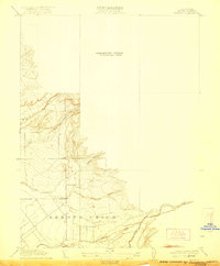
1912 Map of Keefers
USGS Topo · Published 1922About this map
Arroyo Chico defines the southern extent of this 1910 survey, where the drainages of the Sierra Nevada foothills meet the upper Sacramento Valley floor. This preliminary edition, surveyed by R.B. Marshall and his team, provides a detailed look at the hydrology of the area before extensive modern development. The landscape is characterized by the branching paths of Mud Creek, Sycamore Creek, and Chico Creek, which have carved distinct features into the terrain such as Sheep Hollow and Sycamore Hollow. The map captures a transitional geography where seasonal watercourses like Sandy Gulch emerge from the uplands, illustrating the natural drainage patterns that would later influence the agricultural and residential footprint of this portion of Butte County.
Find a feature on this map
7 named features on this map. Tap any name to fly to it.
Don’t see what you’re looking for? This feature index may not catch every label — zoom into the map to look around manually.
Map Details
Editions of this 1912 Keefers Map
2 editions found
Other maps of this area

1891 · Chico
USGS Topo · 1:125,000

1893 · Chico
USGS Topo · 1:125,000

1895 · Chico
USGS Topo · 1:125,000

1912 · Durham
USGS Topo · 1:31,680

1912 · Nord
USGS Topo · 1:31,680

1912 · Chico Landing
USGS Topo · 1:31,680

1912 · Keefers
USGS Topo · 1:31,680

1912 · Clear Creek
USGS Topo · 1:31,680

1912 · Singer Creek
USGS Topo · 1:31,680

1942 · Oroville
USGS Topo · 1:62,500