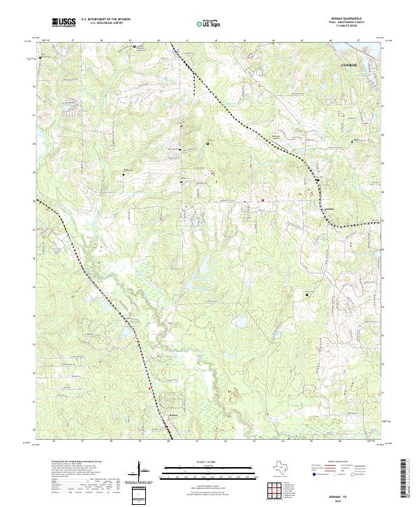
2022 Map of Keenan
USGS Topo · Published 2022About this map
Small rural settlements and numerous family burial grounds define this portion of Montgomery County west of Conroe. The landscape is a network of creek drainages and private lakes, including Mound Cr and the twin reservoirs of Lago del Bosque- Upper Lake and Lago Del Bosque- Lower Lake. The density of small cemeteries such as Saint Beulah Cem, Rabon Chapel Cem, and Womack- Cawthorn- Sturges Cem suggests a long-established pattern of family landholdings and community focal points that persisted even as suburban expansion approached from the east.
Find a feature on this map
127 named features on this map. Tap any name to fly to it.
Don’t see what you’re looking for? This feature index may not catch every label — zoom into the map to look around manually.
Map Details
Editions of this 2022 Keenan Map
This is the sole edition of this map. No revisions or reprints were ever made.
Other maps of this area

1954 · Beaumont
USGS Topo · 1:250,000

1957 · Beaumont
USGS Topo · 1:250,000

1958 · Cowl Spur
USGS Topo · 1:24,000

1958 · Lake Paula
USGS Topo · 1:24,000

1959 · Montgomery
USGS Topo · 1:24,000

1962 · Keenan
USGS Topo · 1:24,000
1962 · Oklahoma
USGS Topo · 1:24,000

1962 · Dacus
USGS Topo · 1:24,000

1962 · Plantersville
USGS Topo · 1:24,000
1962 · Magnolia East
USGS Topo · 1:24,000