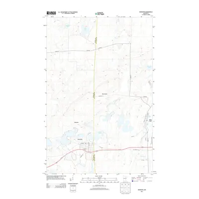
2013 Map of Keewatin
USGS Topo · Published 2013About this map
The boundary between Itasca and Saint Louis counties runs directly through this Mesabi Range landscape, centering on the iron-mining era settlement of Keewatin. This region is defined by its industrial geography, with the community of Stevenson and the rail-oriented hamlet of Kelly Lake situated amidst a complex network of roads including Us-169 and Old Highway 169. The terrain is characterized by the W Swan River and numerous water bodies such as Libby Lake and Horsehead Lake to the north, which contrast with the heavy utility and transport infrastructure of the southern mining districts. Local genealogists will find the Keewatin Cem clearly marked south of the main town site, providing a primary point of reference for family histories in this part of the Iron Range.
Find a feature on this map
37 named features on this map. Tap any name to fly to it.
Don’t see what you’re looking for? This feature index may not catch every label — zoom into the map to look around manually.
Map Details
Editions of this 2013 Keewatin Map
This is the sole edition of this map. No revisions or reprints were ever made.
Other maps of this area

1951 · Hibbing
USGS Topo · 1:24,000

1952 · Keewatin
USGS Topo · 1:24,000

1952 · Riley
USGS Topo · 1:24,000

1952 · Nashwauk
USGS Topo · 1:24,000

1952 · Silica
USGS Topo · 1:24,000

1952 · Pengilly
USGS Topo · 1:24,000

1954 · Hibbing
USGS Topo · 1:250,000

1955 · Dewey Lake
USGS Topo · 1:24,000

1957 · Hibbing
USGS Topo · 1:250,000

1957 · Hibbing
USGS Topo · 1:24,000