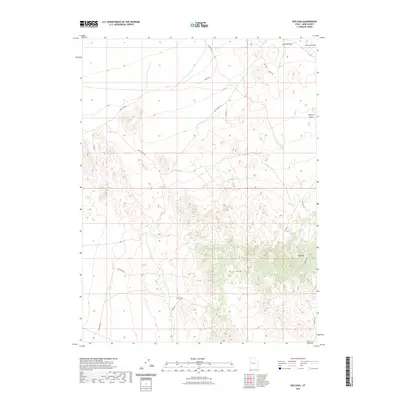
2023 Map of Keg Pass
USGS Topo · Published 2023About this map
Keg Mtn dominates this western Utah landscape, providing a high-relief anchor for the network of unimproved roads and ephemeral drainages that define Juab County’s desert interior. In this contemporary survey, the terrain is marked by descriptive and colorful place names that suggest a long history of cattle ranging and prospecting. Key points of interest for navigation and historical research include Keg Pass and the water source at Keg Spring. The northern portion of the map transitions into the Slow Elk Hills and the broad drainage of Slow Elk Wash. A complex web of tracks like Flint Spring Rd, Mud Rd, and Dead Horse N crisscross the basin, illustrating the continued importance of these remote routes for accessing the high desert and the southern slopes of the mountain range.
Find a feature on this map
19 named features on this map. Tap any name to fly to it.
Don’t see what you’re looking for? This feature index may not catch every label — zoom into the map to look around manually.
Map Details
Editions of this 2023 Keg Pass Map
This is the sole edition of this map. No revisions or reprints were ever made.
Other maps of this area

1885 · Sevier Desert
USGS Topo · 1:250,000

1908 · Fish Springs
USGS Topo · 1:250,000

1910 · Fish Springs
USGS Topo · 1:250,000

1953 · Dugway Range NE
USGS Topo · 1:24,000

1953 · Dugway Pass
USGS Topo · 1:24,000

1953 · Dugway Range
USGS Topo · 1:62,500

1953 · Topaz Mtn
USGS Topo · 1:62,500

1953 · Delta
USGS Topo · 1:250,000
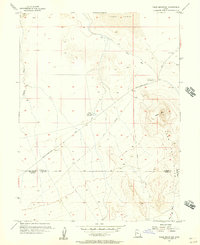
1955 · Table Mountain
USGS Topo · 1:24,000

1955 · Coyote Springs
USGS Topo · 1:24,000