
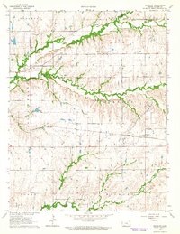
1964 Map of Keighley
USGS Topo · Published 1979About this map
The St Louis-San Francisco railroad cuts a straight line through the Flint Hills landscape of eastern Butler County, anchoring the small settlement of Keighley. This region is defined by the headwaters of the Walnut River system, including the North Branch Walnut River, South Branch Walnut River, and Little Walnut River. These watercourses carve through the upland prairies, creating the distinctive drainage patterns that historically dictated local transportation and land use.
Find a feature on this map
26 named features on this map. Tap any name to fly to it.
Don’t see what you’re looking for? This feature index may not catch every label — zoom into the map to look around manually.
Map Details
Editions of this 1964 Keighley Map
2 editions found
Other maps of this area

1888 · Eldorado
USGS Topo · 1:125,000

1955 · Wichita
USGS Topo · 1:250,000

1958 · Wichita
USGS Topo · 1:250,000

1961 · Pontiac
USGS Topo · 1:24,000

1961 · El Dorado
USGS Topo · 1:24,000

1961 · Rosalia
USGS Topo · 1:24,000

1963 · Leon
USGS Topo · 1:24,000

1964 · Augusta SE
USGS Topo · 1:24,000

1964 · Beaumont
USGS Topo · 1:24,000

1964 · Latham
USGS Topo · 1:24,000