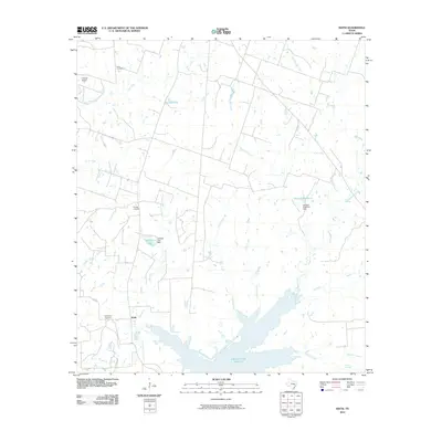
2010 Map of Keith
USGS Topo · Published 2010About this map
Keith serves as the primary settlement hub in this landscape of rural drainage and ranching during the early twenty-first century. The southern portion of the area is dominated by the expansive Gibbons Creek Reservoir, which collects the flow of several local waterways including Hog Creek and Gibbons Creek. This hydrology, punctuated by structures like the Howard Reservoir Dam and Johnson Lake Dam, reflects a managed water system supporting the local environment. For those tracing family histories or early settlement patterns, the map identifies Evergreen Cemetery near the main town site and Enon Cemetery further north, both essential landmarks for local genealogy. The presence of specialized facilities like K Ranch Airport and the Flying J Ranch highlights the ongoing agricultural and private aviation character of this portion of Grimes County, while Kellum Springs remains a notable natural landmark near the southeastern corner.
Find a feature on this map
24 named features on this map. Tap any name to fly to it.
Don’t see what you’re looking for? This feature index may not catch every label — zoom into the map to look around manually.
Map Details
Editions of this 2010 Keith Map
This is the sole edition of this map. No revisions or reprints were ever made.
Other maps of this area

1931 · Iola
USGS Topo · 1:62,500

1954 · Beaumont
USGS Topo · 1:250,000

1954 · Austin
USGS Topo · 1:250,000

1956 · Carlos
USGS Topo · 1:62,500

1957 · Beaumont
USGS Topo · 1:250,000

1959 · Clear Lake
USGS Topo · 1:24,000

1959 · Reliance
USGS Topo · 1:24,000

1959 · Ferguson Crossing
USGS Topo · 1:24,000

1960 · Carlos
USGS Topo · 1:24,000

1961 · Singleton
USGS Topo · 1:24,000