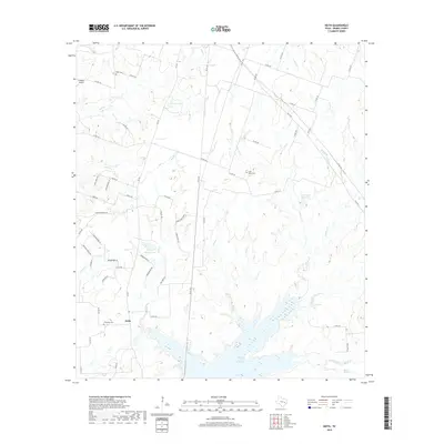
2019 Map of Keith
USGS Topo · Published 2019About this map
Keith serves as the central settlement in this portion of Grimes County, positioned just north of the extensive Gibbons Creek Reservoir. This 2019 survey documents a landscape defined by its creek networks and water resources, with Gibbons Cr, Cedar Cr, and Plum Cr all feeding into the primary reservoir to the south. The area maintains a rural character, evidenced by the distribution of small landing strips like K Ranch Airport and several historic burial grounds including Evergreen Cem, Lake Grove Cem, and Enon Cem. Prominent local landmarks such as Fawn Oaks Ridge and the Kellum Springs area provide distinct geographical points of interest. A dense network of county roads, such as Co RD 164 and Co RD 162, connects these remote homesteads and smaller water bodies like Frances Lake and Howard Reservoir.
Find a feature on this map
69 named features on this map. Tap any name to fly to it.
Don’t see what you’re looking for? This feature index may not catch every label — zoom into the map to look around manually.
Map Details
Editions of this 2019 Keith Map
This is the sole edition of this map. No revisions or reprints were ever made.
Other maps of this area

1931 · Iola
USGS Topo · 1:62,500

1954 · Beaumont
USGS Topo · 1:250,000

1954 · Austin
USGS Topo · 1:250,000

1956 · Carlos
USGS Topo · 1:62,500

1957 · Beaumont
USGS Topo · 1:250,000

1959 · Clear Lake
USGS Topo · 1:24,000

1959 · Reliance
USGS Topo · 1:24,000

1959 · Ferguson Crossing
USGS Topo · 1:24,000

1960 · Carlos
USGS Topo · 1:24,000

1961 · Singleton
USGS Topo · 1:24,000