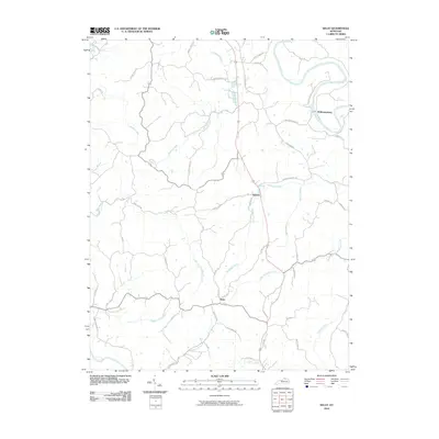
2010 Map of Kelat
USGS Topo · Published 2010About this map
McKinneysburg sits at a sharp oxbow bend of the Licking River in this detailed survey of Pendleton County. The landscape is defined by an intricate network of waterways and ridges, where Richland Creek and its many tributaries, such as Little Richland Creek and Rankin Branch, carve through the terrain. Small settlements like Antioch and Kelat serve as focal points for local travel, connected by a web of rural roads including the distinctive Stratton Pike.
Find a feature on this map
47 named features on this map. Tap any name to fly to it.
Don’t see what you’re looking for? This feature index may not catch every label — zoom into the map to look around manually.
Map Details
Editions of this 2010 Kelat Map
This is the sole edition of this map. No revisions or reprints were ever made.
Other maps of this area

1929 · Cynthiana
USGS Topo · 1:48,000

1930 · Falmouth
USGS Topo · 1:48,000

1934 · Cynthiana
USGS Topo · 1:62,500

1936 · Falmouth
USGS Topo · 1:62,500

1952 · Berlin
USGS Topo · 1:24,000

1952 · Shady Nook
USGS Topo · 1:24,000

1952 · Claysville
USGS Topo · 1:24,000

1953 · Berry
USGS Topo · 1:24,000

1953 · Breckinridge
USGS Topo · 1:24,000

1953 · Kelat
USGS Topo · 1:24,000