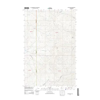
2014 Map of Keller Butte
USGS Topo · Published 2014About this map
Colville Indian Reservation lands dominate this 2014 topographic study, centered on the prominent elevation of Keller Butte. The landscape is defined by a dense network of watercourses and Bureau of Indian Affairs (BIA) routes, illustrating the modern infrastructure within the reservation. The small settlement of Keller sits in the northeastern portion of the map, situated near the intersection of several local drainages. The topography is intricately detailed, showing the steep drainages of Joe Moses Cr and Jack Cr as they carve through the high ground. To the southwest, Buffalo Lake provides a major hydrological landmark, while the southern reaches are marked by the winding paths of Peter Dan Cr and Manila Cr. The map also clearly delineates the administrative boundary between Okanogan Co and Ferry Co.
Find a feature on this map
25 named features on this map. Tap any name to fly to it.
Don’t see what you’re looking for? This feature index may not catch every label — zoom into the map to look around manually.
Map Details
Editions of this 2014 Keller Butte Map
This is the sole edition of this map. No revisions or reprints were ever made.
Other maps of this area

1948 · Grand Coulee Dam
USGS Topo · 1:62,500

1948 · Wilbur
USGS Topo · 1:62,500

1950 · Wilbur
USGS Topo · 1:62,500

1950 · Grand Coulee Dam
USGS Topo · 1:62,500

1950 · Nespelem
USGS Topo · 1:62,500

1952 · Keller
USGS Topo · 1:62,500

1953 · Ritzville
USGS Topo · 1:250,000

1954 · Okanogan
USGS Topo · 1:250,000

1958 · Okanogan
USGS Topo · 1:250,000

1959 · Ritzville
USGS Topo · 1:250,000