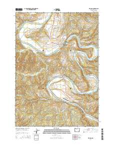
2014 Map of Kellogg
USGS Topo · Published 2014About this map
The Umpqua River winds through a landscape defined by deep relief and tight river bends in Douglas County. Near a prominent loop in the water sits the settlement of Kellogg, serving as a local hub for the surrounding timber and agricultural land. This map provides critical details for genealogists, showing multiple family-named burial sites including Wells Cem, Dimmick Cem, and Kellogg Cem, which are scattered among the river benches and upland ridges.
Find a feature on this map
42 named features on this map. Tap any name to fly to it.
Don’t see what you’re looking for? This feature index may not catch every label — zoom into the map to look around manually.
Map Details
Editions of this 2014 Kellogg Map
This is the sole edition of this map. No revisions or reprints were ever made.
Other maps of this area

1897 · Roseburg
USGS Topo · 1:125,000

1900 · Roseburg
USGS Topo · 1:125,000

1928 · Sitkum
USGS Topo · 1:125,000

1954 · Sutherlin
USGS Topo · 1:62,500

1954 · Drain
USGS Topo · 1:62,500

1955 · Tyee
USGS Topo · 1:62,500

1955 · Elkton
USGS Topo · 1:62,500

1958 · Roseburg
USGS Topo · 1:250,000

1959 · Roseburg
USGS Topo · 1:250,000

1979 · Roseburg
USGS Topo · 1:100,000