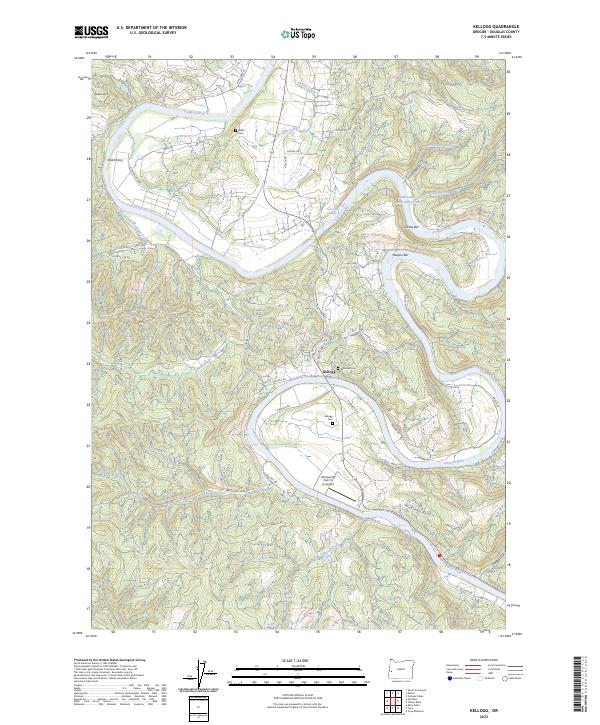
2023 Map of Kellogg
USGS Topo · Published 2023About this map
The Umpqua River snakes through the heart of this Douglas County landscape, defining the character of Kellogg and its surrounding riverbends. The river's influence is evident in the naming of prominent river bars like Maupin Bar and Jones Bar, as well as the historical site of Smith Ferry. This modern topographic study reveals a community deeply rooted in its local geography, with a concentration of genealogical sites such as Kellogg Cem, Dimmick Cem, and Wells Cem clustered near the valley floors. Transportation is dominated by the winding path of State Hwy 138 W and numerous timber and access roads, including The Big K Rd and Upper Mehl Rdg Rd. Unusual features like the Umpqua RV Park Fly In Airport highlight the intersection of recreation and small-scale aviation in this rural corridor.
Find a feature on this map
58 named features on this map. Tap any name to fly to it.
Don’t see what you’re looking for? This feature index may not catch every label — zoom into the map to look around manually.
Map Details
Editions of this 2023 Kellogg Map
This is the sole edition of this map. No revisions or reprints were ever made.
Other maps of this area

1897 · Roseburg
USGS Topo · 1:125,000

1900 · Roseburg
USGS Topo · 1:125,000

1928 · Sitkum
USGS Topo · 1:125,000

1954 · Sutherlin
USGS Topo · 1:62,500

1954 · Drain
USGS Topo · 1:62,500

1955 · Tyee
USGS Topo · 1:62,500

1955 · Elkton
USGS Topo · 1:62,500

1958 · Roseburg
USGS Topo · 1:250,000

1959 · Roseburg
USGS Topo · 1:250,000

1979 · Roseburg
USGS Topo · 1:100,000