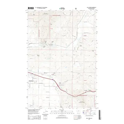
2014 Map of Kelly Creek
USGS Topo · Published 2014About this map
Bozeman expands eastward toward the Bridger Range in this modern topographic study, where the intersection of high-mountain terrain and valley floor dictates local development. The map details the transition from the urban edge of Bozeman to the steep slopes of Drinking Horse Mtn and Mt Baldy. Transport corridors are a primary focus, illustrating the path of the Bozeman Trail Rd and the vital crossings at Kelly Canyon Bridge and Moffit Canyon Bridge over the E Gallatin River. Significant acreage within the Gallatin National Forest remains protected, while the settlement of Chestnut is shown at the southeastern edge of the quadrangle. The land's character is defined by deep incisions like Kelly Canyon and Sypes Canyon, which channel water from the peaks toward the valley's drainage systems.
Find a feature on this map
80 named features on this map. Tap any name to fly to it.
Don’t see what you’re looking for? This feature index may not catch every label — zoom into the map to look around manually.
Map Details
Editions of this 2014 Kelly Creek Map
This is the sole edition of this map. No revisions or reprints were ever made.
Other maps of this area

1888 · Three Forks
USGS Topo · 1:250,000

1891 · Livingston
USGS Topo · 1:250,000

1893 · Livingston
USGS Topo · 1:250,000

1894 · Three Forks
USGS Topo · 1:250,000

1895 · Three Forks
USGS Topo · 1:250,000

1947 · Bozeman
USGS Topo · 1:250,000

1948 · Bozeman
USGS Topo · 1:250,000

1950 · Belgrade
USGS Topo · 1:62,500

1951 · Bozeman Pass
USGS Topo · 1:62,500

1951 · Sedan
USGS Topo · 1:62,500