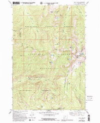
1977 Map of Kelly Lake
USGS Topo · Published 1994About this map
Senate Mine sits high on the slopes of Senate Mountain, a rare industrial mark in this high-altitude landscape where the Continental Divide separates the Deerlodge and Bitterroot National Forests. The region is defined by a dense concentration of glacial cirque lakes, including Ivanhoe Lake, Little Johnson Lake, and Kelly Lake, which feed a complex network of drainages like the Middle Fork Rock Creek and Copper Creek. This area of the Anaconda Range is traversed by various pack trails that navigate steep passes such as Bitterroot Pass. The terrain is characterized by dramatic elevation shifts, where waters from Star Falls and the Alpine Lakes eventually reach the Bitterroot River. This 1970s-era survey captures the primitive nature of the Anaconda-Pintler Wilderness before modern revisions, showing the intersection of four different Montana counties at the high peaks.
Find a feature on this map
41 named features on this map. Tap any name to fly to it.
Don’t see what you’re looking for? This feature index may not catch every label — zoom into the map to look around manually.
Map Details
Editions of this 1977 Kelly Lake Map
3 editions found
Other maps of this area

1908 · Philipsburg
USGS Topo · 1:125,000

1909 · Sapphire
USGS Topo · 1:125,000

1947 · Butte
USGS Topo · 1:250,000

1955 · Dillon
USGS Topo · 1:250,000

1957 · Dillon
USGS Topo · 1:250,000

1958 · Butte
USGS Topo · 1:250,000

1958 · Dillon
USGS Topo · 1:250,000

1960 · Butte
USGS Topo · 1:250,000

1962 · Butte
USGS Topo · 1:250,000

1962 · Dillon
USGS Topo · 1:250,000