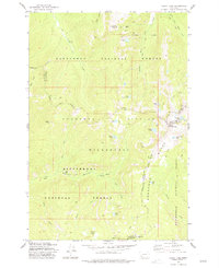
1977 Map of Kelly Lake
USGS Topo · Published 1977About this map
The Anaconda Pintlar Wilderness and the high peaks of the Anaconda Range dominate this mid-1970s survey, where the borders of Granite, Ravalli, Deer Lodge, and Beaverhead counties converge. This high-altitude landscape is defined by its glacial lakes, including Kelly Lake, Ivanhoe Lake, and Little Johnson Lake, which sit below prominent landmarks like Senate Mountain and Pintlar Peak. The presence of the Senate Mine near the northern edge suggests the legacy of mineral exploration that occurred even in these more isolated sections of the Deerlodge National Forest.
Find a feature on this map
39 named features on this map. Tap any name to fly to it.
Don’t see what you’re looking for? This feature index may not catch every label — zoom into the map to look around manually.
Map Details
Editions of this 1977 Kelly Lake Map
3 editions found
Other maps of this area

1908 · Philipsburg
USGS Topo · 1:125,000

1909 · Sapphire
USGS Topo · 1:125,000

1947 · Butte
USGS Topo · 1:250,000

1955 · Dillon
USGS Topo · 1:250,000

1957 · Dillon
USGS Topo · 1:250,000

1958 · Butte
USGS Topo · 1:250,000

1958 · Dillon
USGS Topo · 1:250,000

1960 · Butte
USGS Topo · 1:250,000

1962 · Butte
USGS Topo · 1:250,000

1962 · Dillon
USGS Topo · 1:250,000