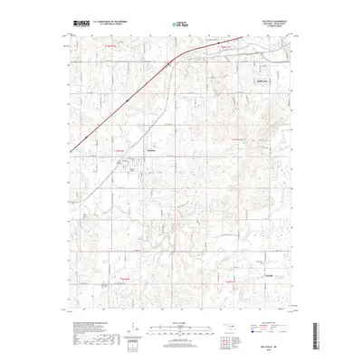
2018 Map of Kellyville
USGS Topo · Published 2018About this map
Kellyville serves as the central hub of this survey, situated at the junction of Buffalo Avenue and Main Street. The town's layout is meticulously detailed, including the Kellyville City Cemetery and the local Post Office. The surrounding landscape of Creek County is defined by a dense network of watercourses and family-legacy landmarks, with Little Polecat Creek and Clear Creek carving through the terrain.
Find a feature on this map
100 named features on this map. Tap any name to fly to it.
Don’t see what you’re looking for? This feature index may not catch every label — zoom into the map to look around manually.
Map Details
Editions of this 2018 Kellyville Map
This is the sole edition of this map. No revisions or reprints were ever made.
Other maps of this area

1901 · Nuyaka
USGS Topo · 1:125,000

1912 · Hominy
USGS Topo · 1:125,000

1914 · Kiefer
USGS Topo · 1:62,500

1915 · Hominy
USGS Topo · 1:125,000

1916 · Kiefer
USGS Topo · 1:62,500

1916 · Bristow
USGS Topo · 1:62,500

1954 · Oklahoma City
USGS Topo · 1:250,000

1955 · Enid
USGS Topo · 1:250,000

1956 · Sapulpa North
USGS Topo · 1:24,000

1957 · Oklahoma City
USGS Topo · 1:250,000