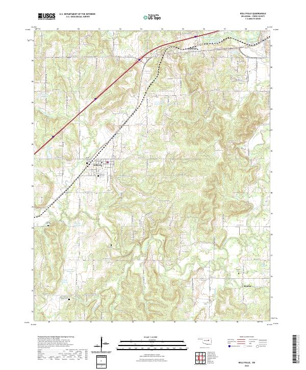
2022 Map of Kellyville
USGS Topo · Published 2022About this map
Family cemeteries and small-town footprints mark the landscape of Creek County in this modern survey. The town of Kellyville serves as a central hub, where the BNSF Railway line cuts through the terrain near the Kellyville City Cem. The surrounding rural acreage is dotted with namesake burial grounds that speak to deep-rooted local genealogy, including the Baker Family Cem, Willie Tiger Cem, and Lester Thomas Family Cem.
Find a feature on this map
110 named features on this map. Tap any name to fly to it.
Don’t see what you’re looking for? This feature index may not catch every label — zoom into the map to look around manually.
Map Details
Editions of this 2022 Kellyville Map
This is the sole edition of this map. No revisions or reprints were ever made.
Other maps of this area

1901 · Nuyaka
USGS Topo · 1:125,000

1912 · Hominy
USGS Topo · 1:125,000

1914 · Kiefer
USGS Topo · 1:62,500

1915 · Hominy
USGS Topo · 1:125,000

1916 · Kiefer
USGS Topo · 1:62,500

1916 · Bristow
USGS Topo · 1:62,500

1954 · Oklahoma City
USGS Topo · 1:250,000

1955 · Enid
USGS Topo · 1:250,000

1956 · Sapulpa North
USGS Topo · 1:24,000

1957 · Oklahoma City
USGS Topo · 1:250,000