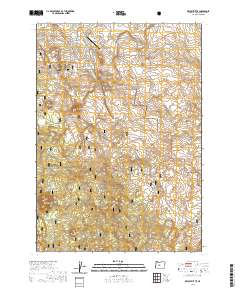
2020 Map of Kelsey Butte
USGS Topo · Published 2020About this map
Deschutes National Forest encompasses the volcanic high desert terrain south of Bend, where the landscape is defined by its subterranean geology and cinder cones. This 2020 survey highlights the unique transition from the pastoral developments around Sundance Meadows Airport to the protected wilderness of the Newberry Volcano region. The area is perforated by subterranean features such as Arnold Ice Cave, Skeleton Cave, and Boyd Cave, which trace the path of historic lava tubes beneath the surface. Water management for the high desert is evidenced by the Arnold Canal in the north, while the southern reaches of the map are punctuated by prominent volcanic formations like Kelsey Butte, Lava Top Butte, and Cabin Butte. The presence of several Swamp Wells suggests the vital importance of groundwater access in this arid pine-and-lava landscape, where recreation trails and OHV routes now crisscross the historic range.
Find a feature on this map
32 named features on this map. Tap any name to fly to it.
Don’t see what you’re looking for? This feature index may not catch every label — zoom into the map to look around manually.
Map Details
Editions of this 2020 Kelsey Butte Map
This is the sole edition of this map. No revisions or reprints were ever made.
Other maps of this area

1926 · Bend
USGS Topo · 1:125,000

1929 · Bend
USGS Topo · 1:125,000

1931 · Newberry Crater
USGS Topo · 1:125,000

1935 · Newberry Crater
USGS Topo · 1:125,000

1955 · Crescent
USGS Topo · 1:250,000

1955 · Bend
USGS Topo · 1:250,000

1957 · Crescent
USGS Topo · 1:250,000

1957 · Bend
USGS Topo · 1:250,000

1958 · Crescent
USGS Topo · 1:250,000

1958 · Bend
USGS Topo · 1:250,000