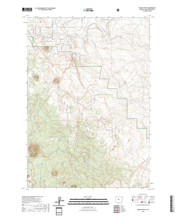
2023 Map of Kelsey Butte
USGS Topo · Published 2023About this map
Deschutes National Forest occupies a significant portion of this landscape, where the northern slopes of the Newberry Volcano meet the high desert plateaus of Central Oregon. The terrain is defined by a series of volcanic features, including Horse Butte, Cabin Butte, and Coyote Butte, which rise above the surrounding plains. The arid environment is managed through the Arnold Canal, while an extensive network of recreational and historic paths, such as the Arnold Ice Cave Trl and Skeleton Cave Trl, provides access to the area's subterranean geology.
Find a feature on this map
37 named features on this map. Tap any name to fly to it.
Don’t see what you’re looking for? This feature index may not catch every label — zoom into the map to look around manually.
Map Details
Editions of this 2023 Kelsey Butte Map
This is the sole edition of this map. No revisions or reprints were ever made.
Other maps of this area

1926 · Bend
USGS Topo · 1:125,000

1929 · Bend
USGS Topo · 1:125,000

1931 · Newberry Crater
USGS Topo · 1:125,000

1935 · Newberry Crater
USGS Topo · 1:125,000

1955 · Crescent
USGS Topo · 1:250,000

1955 · Bend
USGS Topo · 1:250,000

1957 · Crescent
USGS Topo · 1:250,000

1957 · Bend
USGS Topo · 1:250,000

1958 · Crescent
USGS Topo · 1:250,000

1958 · Bend
USGS Topo · 1:250,000