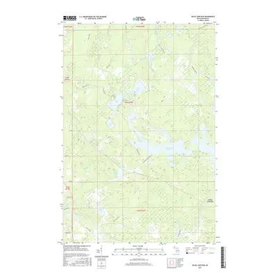
2017 Map of Kelso Junction
USGS Topo · Published 2017About this map
Kelso Junction serves as the focal point for this landscape in the Upper Peninsula, where the Kelso River meets the Paint River. The area is defined by its extensive hydrography, dominated by the Michigamme Reservoir and a network of glacial lakes including Upper Holmes Lake, Lower Holmes Lake, and McCutcheon Lake. The road network, including family-named routes like Nelson Rd and Soderena Rd, reflects the local history of settlement and resource management. Industry is subtly noted through features such as Rock Crusher Rd, pointing to the region's long-standing connection to mining and road-building materials. The terrain is a complex of wetlands and small waterways like Saint Paul Cr and Shenky Cr, illustrating the wild character of Iron County's interior woods as they appeared in the early 21st century.
Find a feature on this map
45 named features on this map. Tap any name to fly to it.
Don’t see what you’re looking for? This feature index may not catch every label — zoom into the map to look around manually.
Map Details
Editions of this 2017 Kelso Junction Map
This is the sole edition of this map. No revisions or reprints were ever made.
Other maps of this area

1895 · Ned Lake
USGS Topo · 1:62,500

1899 · Sagola
USGS Topo · 1:62,500

1899 · Witbeck
USGS Topo · 1:62,500

1899 · Crystal Falls
USGS Topo · 1:62,500

1944 · Crystal Falls
USGS Topo · 1:24,000

1944 · Fortune Lakes
USGS Topo · 1:24,000

1945 · Kelso Junction
USGS Topo · 1:24,000

1945 · Amasa
USGS Topo · 1:24,000

1946 · Crystal Falls
USGS Topo · 1:31,680

1946 · Fortune Lakes
USGS Topo · 1:31,680