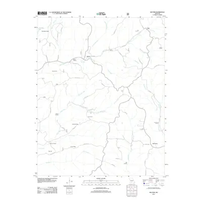
2012 Map of Keltner
USGS Topo · Published 2012About this map
Swan Creek and its many winding tributaries define the topography of this Douglas County landscape, where small rural communities and family cemeteries are scattered across ridges and hollows. The settlement of Keltner serves as a central point along the creek, while Ongo sits to the northeast near the upper reaches of Punching Creek. The area is marked by numerous family-named burial grounds, including the Hall Cemetery, Maggard Cemetery, and Gray Cemetery, which provide significant points of interest for genealogists tracing local families. The terrain transitions from high points like Turnip Knob and Tater Hill down into several named hollows, such as Nance Hollow and Board Hollow. Water sources are plentiful throughout the quadrangle, ranging from the Harmon Spring on Harmon Ridge to the flow of Boulder Fork and Little Cedar Creek. This 2012 survey illustrates a classic Missouri Ozarks settlement pattern of dispersed homesites connected by a network of county roads and named ridges.
Find a feature on this map
55 named features on this map. Tap any name to fly to it.
Don’t see what you’re looking for? This feature index may not catch every label — zoom into the map to look around manually.
Map Details
Editions of this 2012 Keltner Map
This is the sole edition of this map. No revisions or reprints were ever made.
Other maps of this area

1884 · Springfield
USGS Topo · 1:125,000

1886 · Springfield
USGS Topo · 1:125,000

1907 · Forsyth
USGS Topo · 1:125,000

1937 · Bradleyville
USGS Topo · 1:48,000

1937 · Ozark
USGS Topo · 1:48,000

1939 · Fordland
USGS Topo · 1:62,500

1942 · Fordland
USGS Topo · 1:62,500

1943 · Ozark
USGS Topo · 1:62,500

1943 · Bradleyville
USGS Topo · 1:62,500

1945 · Harrison
USGS Topo · 1:250,000