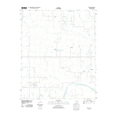
2010 Map of Kemp
USGS Topo · Published 2010About this map
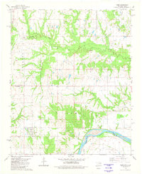
Kemp and the small settlement of Yarnaby anchor this landscape along the northern banks of the Red River near the Oklahoma-Texas border. The area is defined by a dense network of watercourses and floodplains, where Island Bayou meanders through the central terrain alongside numerous small lakes such as Boatner Lake, Robinson Lake, and Garner Lake. The presence of Burney Cemetery and Yarnaby Cemetery provides important landmarks for genealogical research in this rural portion of Bryan County. To the south, the winding course of the Red River marks the state boundary, while further inland, local infrastructure is noted by features like the Oknoname 013013 Reservoir and the Oknoname 013013 Dam. The grid of rural routes, including S Connelly School Rd and Kemp Rd, connects these dispersed homesteads and water bodies.
Find a feature on this map
46 named features on this map. Tap any name to fly to it.
Don’t see what you’re looking for? This feature index may not catch every label — zoom into the map to look around manually.
Map Details
Editions of this 2010 Kemp Map
This is the sole edition of this map. No revisions or reprints were ever made.
Other maps of this area

1954 · Sherman
USGS Topo · 1:250,000

1957 · Wade
USGS Topo · 1:62,500

1958 · Durant
USGS Topo · 1:62,500

1958 · Bonham
USGS Topo · 1:62,500

1958 · Whitesright
USGS Topo · 1:62,500

1958 · Sherman
USGS Topo · 1:250,000
1980 · Durant South
USGS Topo · 1:24,000
1980 · Roberta
USGS Topo · 1:24,000
1980 · Blue
USGS Topo · 1:24,000
1980 · Kemp
USGS Topo · 1:24,000