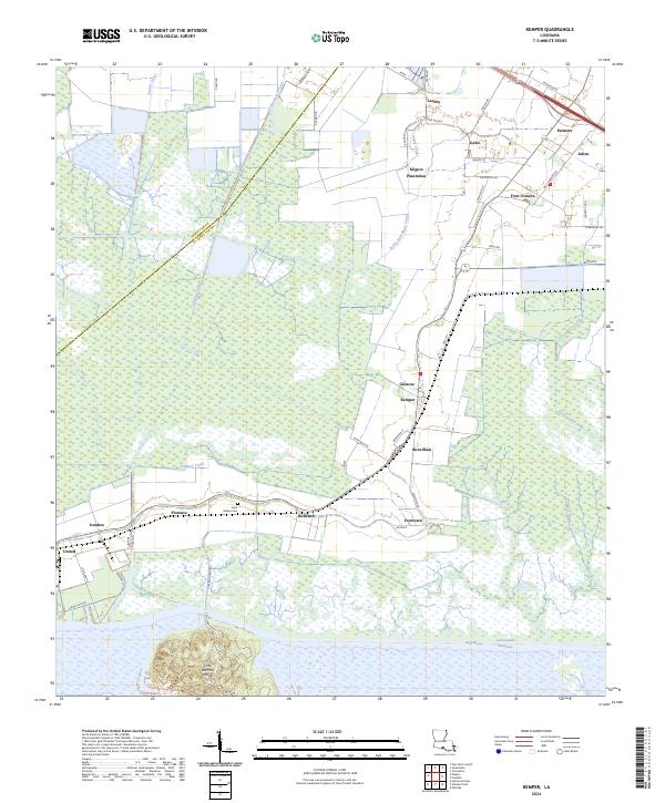
2024 Map of Kemper
USGS Topo · Published 2024About this map
The Iberia-Saint Mary Canal and Phillips Canal dominate this landscape of South Louisiana, where the drainage patterns of the marshland have been heavily modified for transportation and agriculture. Centered on the community of Kemper, the map reveals a series of historic settlements along the high ground, including Glencoe, Richland, and Freetown. The southern portion of the sheet is defined by the expanse of the Intracoastal Waterway and the prominent topographic feature of Cote Blanche Island, which rises above the surrounding Hog Bayou and marsh. This survey illustrates the persistence of older agrarian footprints, such as Kilgore Plantation and Saint Helens Cem, alongside modern infrastructure like Hwy 182. The intricate network of smaller canals, such as Ivanhoe Canal and Kelley Canal, highlights the critical role of water management in sustaining these coastal parish communities.
Find a feature on this map
58 named features on this map. Tap any name to fly to it.
Don’t see what you’re looking for? This feature index may not catch every label — zoom into the map to look around manually.
Map Details
Editions of this 2024 Kemper Map
This is the sole edition of this map. No revisions or reprints were ever made.
Other maps of this area

1937 · Bayou Sale
USGS Topo · 1:62,500

1937 · Jeanerette
USGS Topo · 1:62,500

1937 · Derouen
USGS Topo · 1:62,500

1945 · New Orleans
USGS Topo · 1:250,000

1949 · Cypremort Pt
USGS Topo · 1:31,680

1954 · Jeanerette
USGS Topo · 1:62,500

1957 · Bayou Sale
USGS Topo · 1:62,500

1963 · New Orleans
USGS Topo · 1:250,000
1963 · Weeks
USGS Topo · 1:24,000
1963 · Charenton
USGS Topo · 1:24,000