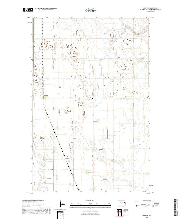
2024 Map of Kempton
USGS Topo · Published 2024About this map
Kempton anchors this agricultural landscape in Grand Forks County, situated along the path of Railroad St and the intersection of several key county routes. The terrain is defined by the subtle drainage of the Little Goose River and Hazen Brook, which carve winding paths through the orderly grid of section lines and township boundaries. This modern survey illustrates a stable rural pattern where transportation and legacy infrastructure intersect, notably at Avon Cem and North Cem. These sites, along with the thoroughfares of Co Rd 6 and Co Rd B12, provide essential reference points for understanding the persistent layout of this North Dakota prairie region.
Find a feature on this map
30 named features on this map. Tap any name to fly to it.
Don’t see what you’re looking for? This feature index may not catch every label — zoom into the map to look around manually.
Map Details
Editions of this 2024 Kempton Map
This is the sole edition of this map. No revisions or reprints were ever made.
Other maps of this area

1934 · Emerado
USGS Topo · 1:48,000

1936 · Emerado
USGS Topo · 1:62,500

1936 · Larimore
USGS Topo · 1:62,500

1952 · Grand Forks
USGS Topo · 1:250,000

1956 · Grand Forks
USGS Topo · 1:250,000

1963 · Larimore East
USGS Topo · 1:24,000

1963 · Kempton
USGS Topo · 1:24,000

1963 · Larimore SW
USGS Topo · 1:24,000

1963 · Larimore West
USGS Topo · 1:24,000

1963 · Emerado SW
USGS Topo · 1:24,000