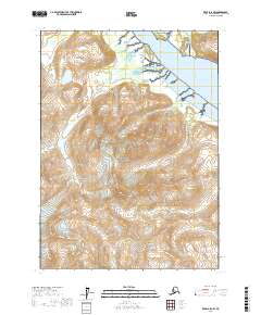
2017 Map of Kenai A-8 NW
USGS Topo · Published 2017About this map
Lake Clark National Park dominates this landscape, where the Tuxedni River flows into the Cook Inlet waters. The terrain is defined by a series of steep drainages, including Difficult Cr and Hungryman Cr, which carve through high elevations before reaching the coastal flats. Near the river mouth, Magnetic Island sits at the head of a wide tidal delta characterized by intricate channel networks. The western portion of the sheet is marked by the winding courses of Open Cr and Open Creek, showing the untouched wilderness preserved within the Lake Clark NP boundaries. This survey provides a precise record of these hydrological patterns and landforms in the early 21st century, illustrating the intersection of alpine watersheds and marine environments.
Find a feature on this map
14 named features on this map. Tap any name to fly to it.
Don’t see what you’re looking for? This feature index may not catch every label — zoom into the map to look around manually.
Map Details
Editions of this 2017 Kenai A-8 NW Map
This is the sole edition of this map. No revisions or reprints were ever made.
Other maps of this area

1944 · Kenai
USGS Topo · 1:250,000

1946 · Lake Clark
USGS Topo · 1:250,000

1950 · Kenai
USGS Topo · 1:250,000

1951 · Lake Clark
USGS Topo · 1:250,000

1958 · Lake Clark A-1
USGS Topo · 1:63,360

1958 · Lake Clark B-1
USGS Topo · 1:63,360
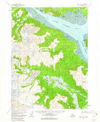
1958 · Kenai A-8
USGS Topo · 1:63,360

1958 · Kenai B-8
USGS Topo · 1:63,360

1958 · Lake Clark
USGS Topo · 1:250,000

1958 · Kenai
USGS Topo · 1:250,000