
1958 Map of Lake Clark B-1
USGS Topo · Published 1962About this map
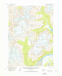
The glacier-carved topography of the Aleutian Range dominates this mid-century survey of the Lake Clark region. The massive Tuxedni Glacier flows from the southwest toward the Tuxedni River, illustrating the glacial dynamics that define this part of Alaska. To the northeast, the Crescent River drains from Crescent Lake 599, cutting through steep terrain as it moves toward the coast. This 1:63,360 scale study provides a clear view of the drainage patterns and permanent snowfields that remained unchanged by human development at the time of the 1958 field annotation. The absence of roads or trails emphasizes the untouched nature of these drainages during the late fifties, serving as a primary record of the physical geography before contemporary environmental shifts.
Find a feature on this map
4 named features on this map. Tap any name to fly to it.
Don’t see what you’re looking for? This feature index may not catch every label — zoom into the map to look around manually.
Map Details
Editions of this 1958 Lake Clark B-1 Map
2 editions found
Other maps of this area

1944 · Kenai
USGS Topo · 1:250,000

1946 · Lake Clark
USGS Topo · 1:250,000

1950 · Kenai
USGS Topo · 1:250,000

1951 · Lake Clark
USGS Topo · 1:250,000

1958 · Lake Clark A-1
USGS Topo · 1:63,360
1958 · Kenai A-8
USGS Topo · 1:63,360

1958 · Kenai B-8
USGS Topo · 1:63,360

1958 · Kenai C-8
USGS Topo · 1:63,360

1958 · Lake Clark C-2
USGS Topo · 1:63,360
1958 · Lake Clark C-1
USGS Topo · 1:63,360