
1958 Map of Kenai B-8
USGS Topo · Published 1963About this map
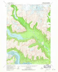
Redoubt Volcano dominates the northern reaches of this coastal Alaskan landscape, overlooking a series of glacial drainages and isolated lakes. This late-1950s survey captures the area before modern infrastructure arrived, showing a wilderness defined by the North Fork Lake and the expansive Crescent Lake. The hydrological network is the primary feature of interest, with the Crescent River winding through narrow valleys toward the coast. To the south, the Tuxedni River empties into a broad Tidal Flat, illustrating the dynamic interface between mountain runoff and the Cook Inlet tides. This sheet preserves the land lines as unsurveyed and unmarked locations predetermined by the Bureau of Land Management, reflecting the raw state of the territory during its early statehood transition.
Find a feature on this map
6 named features on this map. Tap any name to fly to it.
Don’t see what you’re looking for? This feature index may not catch every label — zoom into the map to look around manually.
Map Details
Editions of this 1958 Kenai B-8 Map
2 editions found
Other maps of this area

1944 · Kenai
USGS Topo · 1:250,000

1946 · Lake Clark
USGS Topo · 1:250,000

1950 · Kenai
USGS Topo · 1:250,000

1951 · Lake Clark
USGS Topo · 1:250,000

1958 · Lake Clark A-1
USGS Topo · 1:63,360

1958 · Lake Clark B-1
USGS Topo · 1:63,360
1958 · Kenai A-8
USGS Topo · 1:63,360
1958 · Kenai A-7
USGS Topo · 1:63,360

1958 · Kenai B-7
USGS Topo · 1:63,360

1958 · Kenai C-8
USGS Topo · 1:63,360