
1958 Map of Kenai B-7
USGS Topo · Published 1963About this map
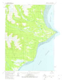
Cook Inlet and Redoubt Bay dominate the eastern reaches of this coastal landscape, where the tides shape a massive tidal flat system. The terrain transitions from the shoreline toward the interior mountains, drained by a series of prominent waterways including the Crescent River and Polly Creek. Small signs of human presence are sparse, indicated only by scattered Cabin and Cabins locations along the coast and near interior lakes like Bear Lake and Wadell Lake. Notable coastal landmarks such as Harriet Pt and Redoubt Pt provide navigational context along the rugged shoreline. The mapping reflects a period when this part of the Kenai Peninsula remained largely untouched by permanent infrastructure, characterized instead by naming conventions tied to local geography and early surveying markers like Redoubt Astro.
Find a feature on this map
17 named features on this map. Tap any name to fly to it.
Don’t see what you’re looking for? This feature index may not catch every label — zoom into the map to look around manually.
Map Details
Editions of this 1958 Kenai B-7 Map
2 editions found
Other maps of this area

1944 · Kenai
USGS Topo · 1:250,000

1950 · Kenai
USGS Topo · 1:250,000
1958 · Kenai A-8
USGS Topo · 1:63,360
1958 · Kenai A-7
USGS Topo · 1:63,360

1958 · Kenai C-6
USGS Topo · 1:63,360

1958 · Kenai B-8
USGS Topo · 1:63,360

1958 · Kenai C-8
USGS Topo · 1:63,360

1958 · Kenai C-7
USGS Topo · 1:63,360
1958 · Kenai B-6
USGS Topo · 1:63,360

1958 · Kenai
USGS Topo · 1:250,000