
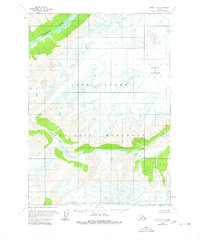
1958 Map of Kenai C-8
USGS Topo · Published 1963About this map
The expansive ice fields of Double Glacier dominate this 1950s survey of the Kenai Peninsula, where active glacial movement is indicated by numerous crevasses across the high-altitude terrain. This environment dictates the drainage patterns of the region, feeding the braided channels of the Tlikakila River in the north and the Drift River to the south. Produced during an era when the Bureau of Land Management was predetermining land lines for unsurveyed territory, the map reveals a wilderness devoid of roads or permanent settlements. The documentation of these water systems and ice flows provides a precise record of the hydrological state of these Alaskan drainages before modern climate shifts. Geologists and researchers can trace the extent of the glacial ice and its relationship to the surrounding river valleys during this mid-century period.
Find a feature on this map
4 named features on this map. Tap any name to fly to it.
Don’t see what you’re looking for? This feature index may not catch every label — zoom into the map to look around manually.
Map Details
Editions of this 1958 Kenai C-8 Map
2 editions found
Other maps of this area

1944 · Kenai
USGS Topo · 1:250,000

1946 · Lake Clark
USGS Topo · 1:250,000

1950 · Kenai
USGS Topo · 1:250,000

1951 · Lake Clark
USGS Topo · 1:250,000

1958 · Lake Clark B-1
USGS Topo · 1:63,360

1958 · Kenai B-7
USGS Topo · 1:63,360

1958 · Kenai B-8
USGS Topo · 1:63,360

1958 · Kenai D-8
USGS Topo · 1:63,360

1958 · Kenai D-7
USGS Topo · 1:63,360

1958 · Kenai C-7
USGS Topo · 1:63,360