
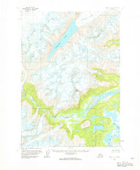
1958 Map of Kenai D-7
USGS Topo · Published 1963About this map
Blockade Glacier and the massive ice field at the northern edge of the Kenai Peninsula dominate this landscape as it was documented in the mid-1950s. The meltwater from this frozen expanse feeds into Blockade Lake, which marks a stark transition between the high-altitude ice and the braided river systems below. To the south, the terrain descends into the complex wetlands of the Big River basin, where the North Fork Big River and South Fork Big River converge amidst a network of glacial runoff and Big Lakes. A solitary Cabin stands as one of the few signs of human presence in this area, situated near Blacksand Creek beneath the heights of Black Peak. This survey provides a baseline for the region before modern changes, illustrating the natural hydrological connection between the interior glaciers and the coastal river valleys.
Find a feature on this map
9 named features on this map. Tap any name to fly to it.
Don’t see what you’re looking for? This feature index may not catch every label — zoom into the map to look around manually.
Map Details
Editions of this 1958 Kenai D-7 Map
2 editions found
Other maps of this area

1944 · Kenai
USGS Topo · 1:250,000

1949 · Tyonek
USGS Topo · 1:250,000

1950 · Kenai
USGS Topo · 1:250,000

1951 · Tyonek
USGS Topo · 1:250,000

1958 · Tyonek A-6
USGS Topo · 1:63,360

1958 · Kenai C-6
USGS Topo · 1:63,360

1958 · Kenai D-8
USGS Topo · 1:63,360

1958 · Kenai D-6
USGS Topo · 1:63,360

1958 · Kenai C-8
USGS Topo · 1:63,360

1958 · Kenai C-7
USGS Topo · 1:63,360