
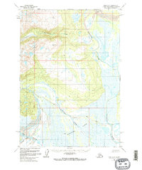
1958 Map of Kenai D-6
USGS Topo · Published 1963About this map
The Bachatna River and Kustatan River dominate this coastal Alaskan landscape, weaving through a complex network of wetlands and tidal Flats. This mid-century topographical survey captures a wilderness largely defined by its water systems, including the Blacksand Creek drainage and the North Fork. Human presence is minimal, marked only by isolated infrastructure like a Landing Strip and a solitary Cabin near the riverbanks. The mapping of Bachatna Creek and the West Fork illustrates the intricate hydrology of the Kenai region before major modern development. This document provides a record of the shifting channels and alluvial deposits that characterize the mouths of the South Fork Big River, offering specialized detail for those studying the geomorphology or early aviation history of this remote territory.
Find a feature on this map
11 named features on this map. Tap any name to fly to it.
Don’t see what you’re looking for? This feature index may not catch every label — zoom into the map to look around manually.
Map Details
Editions of this 1958 Kenai D-6 Map
3 editions found
Other maps of this area

1944 · Kenai
USGS Topo · 1:250,000

1949 · Tyonek
USGS Topo · 1:250,000

1950 · Kenai
USGS Topo · 1:250,000

1951 · Tyonek
USGS Topo · 1:250,000

1958 · Tyonek A-6
USGS Topo · 1:63,360

1958 · Tyonek A-5
USGS Topo · 1:63,360

1958 · Kenai C-5
USGS Topo · 1:63,360

1958 · Kenai D-5
USGS Topo · 1:63,360

1958 · Kenai C-6
USGS Topo · 1:63,360

1958 · Kenai D-7
USGS Topo · 1:63,360