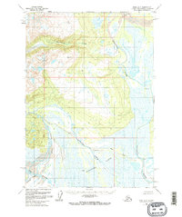
1958 Map of Kenai D-6
USGS Topo · Published 1974About this map
The Kustatatan River defines the eastern landscape of this mid-century survey, winding through a complex network of wetlands and tidal Flats. This area of the Kenai Peninsula shows an early stage of resource exploration and remote access, with several Cabins and a Landing Strip positioned near the convergence of Bachatna Creek and its southern tributaries. The topographic detail captures the hydraulic patterns where the North Fork Big River and South Fork Big River meet the coastal lowlands.
Find a feature on this map
11 named features on this map. Tap any name to fly to it.
Don’t see what you’re looking for? This feature index may not catch every label — zoom into the map to look around manually.
Map Details
Editions of this 1958 Kenai D-6 Map
3 editions found
Other maps of this area

1944 · Kenai
USGS Topo · 1:250,000

1949 · Tyonek
USGS Topo · 1:250,000

1950 · Kenai
USGS Topo · 1:250,000

1951 · Tyonek
USGS Topo · 1:250,000

1958 · Tyonek A-6
USGS Topo · 1:63,360

1958 · Tyonek A-5
USGS Topo · 1:63,360

1958 · Kenai C-5
USGS Topo · 1:63,360

1958 · Kenai D-5
USGS Topo · 1:63,360

1958 · Kenai C-6
USGS Topo · 1:63,360

1958 · Kenai D-6
USGS Topo · 1:63,360