
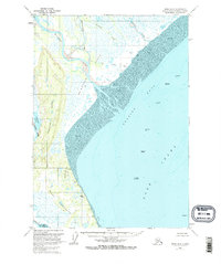
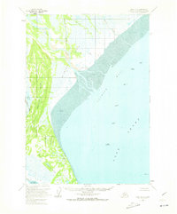
1958 Map of Kenai D-5
USGS Topo · Published 1963About this map
Trading Bay and the northern reaches of Cook Inlet dominate this coastal survey, where the massive discharge of glacial river systems meets the sea. The landscape is defined by an intricate network of waterways including the Chakachatna River, Mc Arthur River, and Middle River, which meander through expansive tidal areas known as the Flats. This environment is characterized by shifting Tidal Flats and secondary channels like Cottonwood Slough. Human presence is sparse, marked primarily by isolated Cabins and a lone Landing Strip near the coast, suggesting a reliance on bush planes for access. The interior features the Kustatan River winding along a prominent Ridge, with Bunitlana Lake tucked into the western terrain, illustrating the complex drainage patterns of the Kenai Peninsula's western shore before significant modern development.
Find a feature on this map
16 named features on this map. Tap any name to fly to it.
Don’t see what you’re looking for? This feature index may not catch every label — zoom into the map to look around manually.
Map Details
Editions of this 1958 Kenai D-5 Map
3 editions found
Other maps of this area

1944 · Kenai
USGS Topo · 1:250,000

1949 · Tyonek
USGS Topo · 1:250,000

1950 · Kenai
USGS Topo · 1:250,000

1950 · Kenai D-4
USGS Topo · 1:63,360

1951 · Tyonek
USGS Topo · 1:250,000

1951 · Kenai C-4
USGS Topo · 1:63,360

1952 · Kenai D-4
USGS Topo · 1:63,360

1952 · Kenai C-4
USGS Topo · 1:63,360

1958 · Tyonek A-6
USGS Topo · 1:63,360

1958 · Tyonek A-5
USGS Topo · 1:63,360