1952 Map of Kenai D-4
USGS Topo · Published 1954About this map
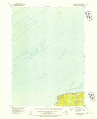
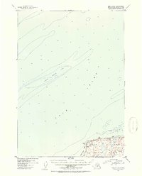
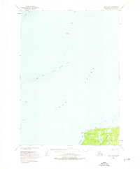
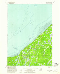
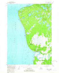
Cook Inlet dominates this coastal survey, where the seafloor is meticulously charted with soundings and depth curves compiled from maritime charts. The central expanse is marked by the long, narrow Middle Ground Shoal, a significant maritime hazard in the middle of the inlet. Along the southeastern shoreline, the land rises into the northern reaches of the Kenai National Moose Range, a protected wilderness area that characterizes the interior of the peninsula during this era. Small signs of human presence appear at Nikishka Bay, where scattered Cabins sit near the coast. Notable coastal landmarks such as Boulder Point and Jumbo Rock provide reference for navigation along a shoreline that remained largely undeveloped in the early 1950s.
Find a feature on this map
7 named features on this map. Tap any name to fly to it.
Don’t see what you’re looking for? This feature index may not catch every label — zoom into the map to look around manually.
Map Details
Editions of this 1952 Kenai D-4 Map
3 editions found

Other maps of this area

1944 · Kenai
USGS Topo · 1:250,000

1949 · Tyonek
USGS Topo · 1:250,000

1950 · Kenai
USGS Topo · 1:250,000

1950 · Kenai C-3
USGS Topo · 1:63,360
1950 · Kenai D-4
USGS Topo · 1:63,360

1951 · Tyonek
USGS Topo · 1:250,000
1951 · Kenai D-3
USGS Topo · 1:63,360
1951 · Kenai C-4
USGS Topo · 1:63,360
1951 · Kenai C-3
USGS Topo · 1:63,360
1952 · Kenai D-3
USGS Topo · 1:63,360