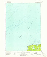
1952 Map of Kenai D-4
USGS Topo · Published 1959About this map
Cook Inlet dominates this mid-century hydrographic and topographic study, revealing the treacherous underwater geography of the Middle Ground Shoal. Along the southern shoreline, the boundary of the Kenai National Moose Range is established, protecting the wilderness just inland from the coastal bluffs. The map provides a detailed look at the maritime hazards and coastal features of the Kenai Peninsula before the era of intensive industrial development. Sounding data throughout the inlet clarifies the deep-water channels, while shore-side landmarks like Boulder Point and Jumbo Rock served as vital visual aids for coastal navigation. Scattered Cabins near Nikishka Bay represent the sparse human footprint in this remote region during the early 1950s.
Find a feature on this map
7 named features on this map. Tap any name to fly to it.
Don’t see what you’re looking for? This feature index may not catch every label — zoom into the map to look around manually.
Map Details
Editions of this 1952 Kenai D-4 Map
3 editions found

Other maps of this area

1944 · Kenai
USGS Topo · 1:250,000

1949 · Tyonek
USGS Topo · 1:250,000

1950 · Kenai
USGS Topo · 1:250,000

1950 · Kenai C-3
USGS Topo · 1:63,360

1950 · Kenai D-4
USGS Topo · 1:63,360

1951 · Tyonek
USGS Topo · 1:250,000

1951 · Kenai D-3
USGS Topo · 1:63,360

1951 · Kenai C-4
USGS Topo · 1:63,360

1951 · Kenai C-3
USGS Topo · 1:63,360

1952 · Kenai D-3
USGS Topo · 1:63,360