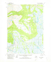
1958 Map of Kenai D-6
USGS Topo · Published 1974About this map
The Kustatan River meanders through an intricate network of wetlands and river forks on the western side of Cook Inlet during the mid-1950s. This survey, based on aerial photography from 1952 to 1955, illustrates a landscape defined by glacial runoff and shifting watercourses, including the Bachatna Creek and the South Fork Big River. The topography transitions from the alluvial Bachatna Flats to the rising elevations marked by Blacksand Creek and the survey point at VABM 2969 Good. Evidence of early resource exploration and remote access is visible through scattered Drill Holes, a isolated Cabin, and a small Landing Strip. These features highlight the area's role as a frontier for geological assessment and aviation-dependent transportation in the years immediately following the territorial era.
Find a feature on this map
12 named features on this map. Tap any name to fly to it.
Don’t see what you’re looking for? This feature index may not catch every label — zoom into the map to look around manually.
Map Details
Editions of this 1958 Kenai D-6 Map
3 editions found
Other maps of this area

1944 · Kenai
USGS Topo · 1:250,000

1949 · Tyonek
USGS Topo · 1:250,000

1950 · Kenai
USGS Topo · 1:250,000

1951 · Tyonek
USGS Topo · 1:250,000

1958 · Tyonek A-6
USGS Topo · 1:63,360

1958 · Tyonek A-5
USGS Topo · 1:63,360

1958 · Kenai C-5
USGS Topo · 1:63,360

1958 · Kenai D-5
USGS Topo · 1:63,360

1958 · Kenai C-6
USGS Topo · 1:63,360

1958 · Kenai D-6
USGS Topo · 1:63,360