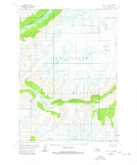
1958 Map of Kenai C-8
USGS Topo · Published 1980About this map
Lake Clark National Monument encompasses a significant portion of this late 1950s terrain, showing a wilderness defined by glacial activity and drainage systems before the area gained national park status. The landscape is dominated by the Double Glacier in the northeast, where the presence of numerous crevasses indicates an active and shifting ice mass. These glacial waters feed into prominent drainage networks including the Tlikakila River and the Drift River. This period of surveying, based on mid-century aerial photography, documents the untouched topography of the Alaska Range without the roads or trails common in more settled regions. The map serves as a primary record of the glacial extent and river braiding patterns that have since evolved through natural environmental shifts.
Find a feature on this map
5 named features on this map. Tap any name to fly to it.
Don’t see what you’re looking for? This feature index may not catch every label — zoom into the map to look around manually.
Map Details
Editions of this 1958 Kenai C-8 Map
2 editions found
Other maps of this area

1944 · Kenai
USGS Topo · 1:250,000

1946 · Lake Clark
USGS Topo · 1:250,000

1950 · Kenai
USGS Topo · 1:250,000

1951 · Lake Clark
USGS Topo · 1:250,000

1958 · Lake Clark B-1
USGS Topo · 1:63,360

1958 · Kenai B-7
USGS Topo · 1:63,360

1958 · Kenai B-8
USGS Topo · 1:63,360

1958 · Kenai D-8
USGS Topo · 1:63,360

1958 · Kenai C-8
USGS Topo · 1:63,360

1958 · Kenai D-7
USGS Topo · 1:63,360