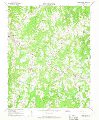
1966 Map of Kenbridge East
USGS Topo · Published 1968About this map
Kenbridge serves as the primary hub of this rural Southside Virginia landscape, situated at the junction of several key routes in western Lunenburg County. The town's industrial and transport identity is defined by the Norfolk and Western railroad, which cuts a diagonal path through the terrain, connecting the main settlement to Bishops Corner and the community of Dundas to the southeast. The landscape is a network of ridges and drainages, including Crooked Creek and Stony Creek, which have dictated the placement of many early homesteads and cemeteries.
Find a feature on this map
32 named features on this map. Tap any name to fly to it.
Don’t see what you’re looking for? This feature index may not catch every label — zoom into the map to look around manually.
Map Details
Editions of this 1966 Kenbridge East Map
3 editions found
Other maps of this area

1891 · Farmville
USGS Topo · 1:125,000

1893 · Farmville
USGS Topo · 1:125,000

1897 · Amelia
USGS Topo · 1:125,000

1918 · Lawrenceville
USGS Topo · 1:62,500

1920 · Lawrenceville
USGS Topo · 1:48,000

1921 · Lawrenceville
USGS Topo · 1:62,500

1942 · Lawrenceville
USGS Topo · 1:62,500

1943 · Richmond
USGS Topo · 1:250,000

1947 · Roanoke
USGS Topo · 1:250,000

1949 · Richmond
USGS Topo · 1:250,000