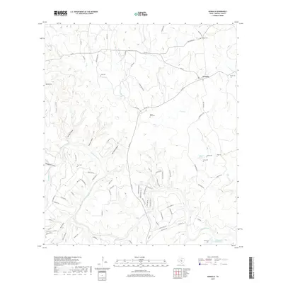
2019 Map of Kendalia
USGS Topo · Published 2019About this map
Kendalia serves as the central hub of this Texas Hill Country landscape, situated near the intersection of FM 473 and FM 3551 N. The geography is defined by a dense network of canyons and watercourses, including Coyote Canyon, Carlisle Canyon, and Heiligmann Canyon, which drain toward the prominent Guadalupe River in the south. Genealogists will find a high density of family burial grounds scattered across the terrain, from Jones Cem and Knuepper Cem in the north to Richter Cem near the riverbanks. The settlement pattern follows the winding paths of Curry Cr and its tributaries, with local history preserved in names like Herbst - Patton Cem and Lawhon Cem. The presence of several named canyons and the elevation at Round Mtn illustrate a transition from upland plateaus to the river valley floor, where KWW Ranch Lake Number 1 provides a rare contained water feature among the natural seasonal creeks.
Find a feature on this map
82 named features on this map. Tap any name to fly to it.
Don’t see what you’re looking for? This feature index may not catch every label — zoom into the map to look around manually.
Map Details
Editions of this 2019 Kendalia Map
This is the sole edition of this map. No revisions or reprints were ever made.
Other maps of this area

1887 · Blanco
USGS Topo · 1:125,000

1894 · Fredericksburg
USGS Topo · 1:125,000

1894 · Blanco
USGS Topo · 1:125,000

1920 · Smithsons Valley
USGS Topo · 1:62,500

1927 · Smithson Valley
USGS Topo · 1:62,500

1929 · Smithson Valley
USGS Topo · 1:62,500

1940 · Smithson Valley
USGS Topo · 1:62,500

1954 · Llano
USGS Topo · 1:250,000

1954 · San Antonio
USGS Topo · 1:250,000

1955 · Llano
USGS Topo · 1:250,000