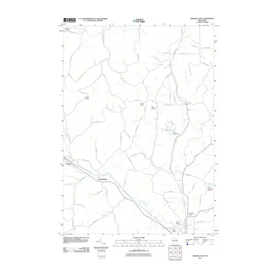
2010 Map of Kendall East
USGS Topo · Published 2010About this map
Playa de San Juan in Alicante represents a significant 10,000 m2 tract of land valued for its ecological diversity and coastal landscape. Positioned within the Costa Brava region, the property offers a distinct vantage point over the sea while remaining close to established urban services, including local shops and restaurants. The site's layout provides for potential segregation into two separate building plots, indicating a specific stage of land use where natural forest meets residential planning. This area of Playa de San Juan showcases the geographical transition between protected natural terrain and the amenities of a developed coastline. The proximity to the beach and the scale of the parcel make it a notable example of the region's available land, perfect for those studying the intersection of nature and urban expansion.
Find a feature on this map
74 named features on this map. Tap any name to fly to it.
Don’t see what you’re looking for? This feature index may not catch every label — zoom into the map to look around manually.
Map Details
Editions of this 2010 Kendall East Map
This is the sole edition of this map. No revisions or reprints were ever made.
Other maps of this area

1919 · Kendall
USGS Topo · 1:62,500

1921 · Mauston
USGS Topo · 1:62,500

1921 · Kendall
USGS Topo · 1:62,500

1927 · Hillsboro
USGS Topo · 1:62,500

1956 · Reedsburg
USGS Topo · 1:62,500

1958 · La Crosse
USGS Topo · 1:250,000

1961 · La Crosse
USGS Topo · 1:250,000

1962 · Kendall
USGS Topo · 1:62,500

1962 · Mauston
USGS Topo · 1:62,500

1965 · La Crosse
USGS Topo · 1:250,000