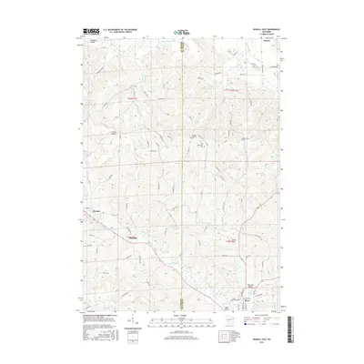
2016 Map of Kendall East
USGS Topo · Published 2016About this map
The Baraboo River and the Little Lemonweir River define the undulating landscape of this border region between Monroe and Juneau Counties. Settled along the riverbanks and nestled in topographic depressions like Glassman Valley, Sherman Valley, and Mack Valley, towns such as Elroy and Kendall serve as anchor points for a network of rural roads including Co Hwy N and Co Hwy P. The terrain is characterized by prominent elevations like Clifton Ridge, which rise above the surrounding valleys.
Find a feature on this map
86 named features on this map. Tap any name to fly to it.
Don’t see what you’re looking for? This feature index may not catch every label — zoom into the map to look around manually.
Map Details
Editions of this 2016 Kendall East Map
This is the sole edition of this map. No revisions or reprints were ever made.
Other maps of this area

1919 · Kendall
USGS Topo · 1:62,500

1921 · Mauston
USGS Topo · 1:62,500

1921 · Kendall
USGS Topo · 1:62,500

1927 · Hillsboro
USGS Topo · 1:62,500

1956 · Reedsburg
USGS Topo · 1:62,500

1958 · La Crosse
USGS Topo · 1:250,000

1961 · La Crosse
USGS Topo · 1:250,000

1962 · Kendall
USGS Topo · 1:62,500

1962 · Mauston
USGS Topo · 1:62,500

1965 · La Crosse
USGS Topo · 1:250,000