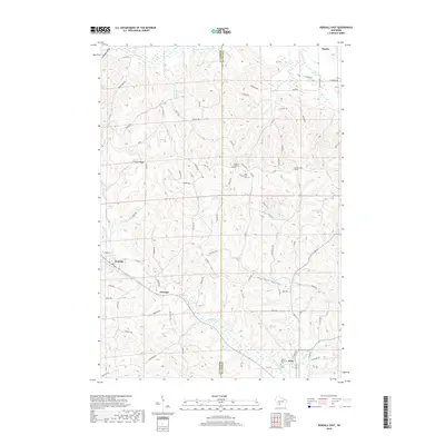
2018 Map of Kendall East
USGS Topo · Published 2018About this map
The Baraboo River carves through the central valley of this Juneau and Monroe County borderland, defining the corridor where the settlement of Kendall sits at the western edge. This area is characterized by deep drainage valleys like Sherman Valley and Grassman Valley, separated by prominent elevations such as Clifton-Ridge. The landscape's historical footprint is anchored by several rural burial grounds, including Fountain Lutheran Cem, West Lemonweir Cem, and Fowler-Sherman Cem, which serve as quiet markers of the farming communities that established themselves along the ridges. To the north, the Little Lemonweir River flows through more open terrain near Hustler, while a network of rural roads like Lumber Ave and Mustang Ave connects the small clusters of homes at Glendale to the surrounding hills. Artificial water management is evident through the 0 36 Reservoir and 0 1 Reservoir, supporting the local watershed and agricultural needs.
Find a feature on this map
76 named features on this map. Tap any name to fly to it.
Don’t see what you’re looking for? This feature index may not catch every label — zoom into the map to look around manually.
Map Details
Editions of this 2018 Kendall East Map
This is the sole edition of this map. No revisions or reprints were ever made.
Other maps of this area

1919 · Kendall
USGS Topo · 1:62,500

1921 · Mauston
USGS Topo · 1:62,500

1921 · Kendall
USGS Topo · 1:62,500

1927 · Hillsboro
USGS Topo · 1:62,500

1956 · Reedsburg
USGS Topo · 1:62,500

1958 · La Crosse
USGS Topo · 1:250,000

1961 · La Crosse
USGS Topo · 1:250,000

1962 · Kendall
USGS Topo · 1:62,500

1962 · Mauston
USGS Topo · 1:62,500

1965 · La Crosse
USGS Topo · 1:250,000