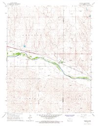
1966 Map of Kendall
USGS Topo · Published 1967About this map
The Arkansas River valley defines this mid-1960s survey of western Kansas, where the community of Kendall serves as a focal point for the surrounding high plains. The landscape is a study in industrial and environmental shifts, featuring extensive shifting sand deposits south of the river and a growing grid of energy infrastructure marked by numerous Gas Wells and a Drill Hole. Transport history is deeply etched into the terrain via the Atchison Topeka and Santa Fe railroad and the Fort Aubrey Road, reflecting the corridor's long-standing importance for movement across the Arkansas valley.
Find a feature on this map
14 named features on this map. Tap any name to fly to it.
Don’t see what you’re looking for? This feature index may not catch every label — zoom into the map to look around manually.
Map Details
Editions of this 1966 Kendall Map
This is the sole edition of this map. No revisions or reprints were ever made.
Other maps of this area

1891 · Larned
USGS Topo · 1:125,000

1900 · Syracuse
USGS Topo · 1:125,000

1900 · Lakin
USGS Topo · 1:125,000

1920 · Syracuse
USGS Topo · 1:125,000

1955 · Dodge City
USGS Topo · 1:250,000

1955 · Scott City
USGS Topo · 1:250,000

1958 · Dodge City
USGS Topo · 1:250,000

1958 · Scott City
USGS Topo · 1:250,000

1959 · Dodge City
USGS Topo · 1:250,000

1966 · Syracuse East SW
USGS Topo · 1:24,000