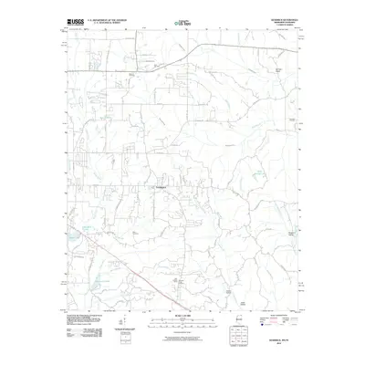
2010 Map of Kendrick
USGS Topo · Published 2010About this map
Farmington serves as the primary hub in this Alcorn County landscape, where the Tennessee-Mississippi state line defines the northern boundary. The terrain is a complex network of small drainages and hollows, including Sorghum Hollow and Lewis Hollow, which cut through the land toward larger water bodies like Waukomis Lake and Liddon Lake. Local genealogy and community history are anchored by several family and church burial grounds, such as Marvin Cemetery, Wyly Cemetery, and the Pleasant Ridge Cemetery situated near the Glen Lookout Tower. This high point offers a strategic overlook of the surrounding timber and agricultural plots. Movement through the area is dictated by a dense grid of county roads, including Oakland School Rd and Farmington Church Rd, reflecting a settlement pattern deeply tied to local education and faith centers. The presence of Springer Glade in the northeast and numerous branches like Chambers Creek and Babb Branch highlight the well-watered nature of this border country.
Find a feature on this map
82 named features on this map. Tap any name to fly to it.
Don’t see what you’re looking for? This feature index may not catch every label — zoom into the map to look around manually.
Map Details
Editions of this 2010 Kendrick Map
This is the sole edition of this map. No revisions or reprints were ever made.
Other maps of this area

1935 · Doskie
USGS Topo · 1:24,000

1935 · Leedy
USGS Topo · 1:24,000

1935 · Glens
USGS Topo · 1:24,000

1936 · Counce
USGS Topo · 1:24,000

1936 · Kendrick
USGS Topo · 1:24,000

1936 · Michie
USGS Topo · 1:24,000
1949 · Counce
USGS Topo · 1:24,000

1949 · Michie
USGS Topo · 1:24,000

1950 · Corinth
USGS Topo · 1:62,500

1950 · Kendrick
USGS Topo · 1:24,000