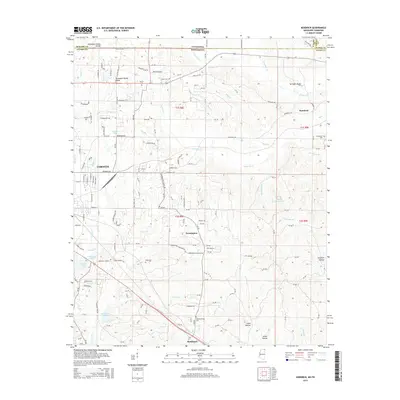
2015 Map of Kendrick
USGS Topo · Published 2015About this map
Tennessee Valley Divide snakes across the northern landscape of Alcorn County, Mississippi, and into Tennessee, defining the drainage patterns for numerous creeks and branches. The terrain is marked by significant hydrological features including Seven Springs Lake and several man-made impoundments like Hillandale Lake and Liddon Lake. These waters feed into systems such as Sevenmile Creek and Clear Creek, which navigate the undulating topography.
Find a feature on this map
164 named features on this map. Tap any name to fly to it.
Don’t see what you’re looking for? This feature index may not catch every label — zoom into the map to look around manually.
Map Details
Editions of this 2015 Kendrick Map
This is the sole edition of this map. No revisions or reprints were ever made.
Other maps of this area

1935 · Doskie
USGS Topo · 1:24,000

1935 · Leedy
USGS Topo · 1:24,000

1935 · Glens
USGS Topo · 1:24,000

1936 · Counce
USGS Topo · 1:24,000

1936 · Kendrick
USGS Topo · 1:24,000

1936 · Michie
USGS Topo · 1:24,000
1949 · Counce
USGS Topo · 1:24,000

1949 · Michie
USGS Topo · 1:24,000

1950 · Corinth
USGS Topo · 1:62,500

1950 · Kendrick
USGS Topo · 1:24,000