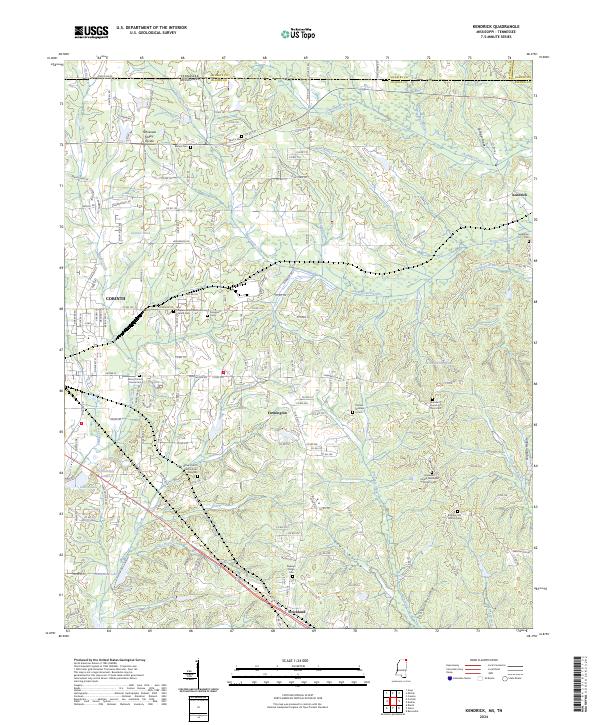
2024 Map of Kendrick
USGS Topo · Published 2024About this map
Shiloh National Battlefield spans the northern landscape of this Alcorn County quadrangle, where the terrain is marked by the significant Tennessee Valley Divide. This height of land separates the headwaters of numerous creeks including Sevenmile Creek and Clear Creek as they wind through the hills of Mississippi and Tennessee. The settlement pattern reflects deep-rooted community history, with the town of Farmington and smaller nodes like Kendrick and Strickland serving as anchors. For genealogists and local historians, the abundance of small family and community burial grounds is striking, including the Wiley Grove Church Cem African American and the Alcorn County Home Cem. The map reveals a rural landscape where life is tied to the creek hollows, such as Lewis Hollow and Sorghum Hollow, and the numerous small impoundments like Hillandale Lake and Waukomis Lake that dot the countryside.
Find a feature on this map
60 named features on this map. Tap any name to fly to it.
Don’t see what you’re looking for? This feature index may not catch every label — zoom into the map to look around manually.
Map Details
Editions of this 2024 Kendrick Map
This is the sole edition of this map. No revisions or reprints were ever made.
Other maps of this area

1935 · Doskie
USGS Topo · 1:24,000

1935 · Leedy
USGS Topo · 1:24,000

1935 · Glens
USGS Topo · 1:24,000

1936 · Counce
USGS Topo · 1:24,000

1936 · Kendrick
USGS Topo · 1:24,000

1936 · Michie
USGS Topo · 1:24,000
1949 · Counce
USGS Topo · 1:24,000

1949 · Michie
USGS Topo · 1:24,000

1950 · Corinth
USGS Topo · 1:62,500

1950 · Kendrick
USGS Topo · 1:24,000