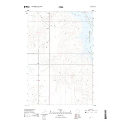
2017 Map of Kenel
USGS Topo · Published 2017About this map
Kenel sits atop the dissected plateau overlooking the Missouri River valley, now dominated by the expansive waters of Lake Oahe. The landscape is characterized by a complex network of drainage ravines, including Blackhawk Cr and Mad Bear Cr, which carve through the high ground of Corson County. For genealogists and local historians, the area is defined by its parish landmarks and burial grounds, such as the Church of the Assumption of the Blessed Virgin Cem, Saint Thomas Cem, and Saint Lukes Cem. This 2017 edition records the modern road network, including Riverside Rd and Old Kenel Rd, providing a clear view of the interface between the rolling upland topography and the stabilized shoreline of the reservoir.
Find a feature on this map
19 named features on this map. Tap any name to fly to it.
Don’t see what you’re looking for? This feature index may not catch every label — zoom into the map to look around manually.
Map Details
Editions of this 2017 Kenel Map
This is the sole edition of this map. No revisions or reprints were ever made.
Other maps of this area

1953 · McIntosh
USGS Topo · 1:250,000

1956 · Wakpala
USGS Topo · 1:24,000

1958 · McIntosh
USGS Topo · 1:250,000

1965 · Pollock SE
USGS Topo · 1:24,000

1965 · Pollock
USGS Topo · 1:24,000

1966 · Mahto NE
USGS Topo · 1:24,000

1966 · Kenel
USGS Topo · 1:24,000

1966 · Kline Buttes
USGS Topo · 1:24,000

1966 · Pollock NW
USGS Topo · 1:24,000

1967 · Mobridge NE
USGS Topo · 1:24,000